I woke up this morning to the percussion of hard, fast rains hitting our tin roof… In my foggy state of slumber, I bumped Ed’s shoulder, “How are you going to take out the dogs?”
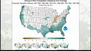
Rolling over, I started thinking about what I’d heard on Tuesday’s Army Corp of Engineer Periodic Scientist Call: “…How are we going to prepare if NOAA’s El Nino rain predictions are right? What if there is up to seven feet of water that fills the lake?….”
Seven feet? That would mean releases from Lake Okeechobee this Florida winter.
NOAA reports this El Niño as among the strongest on record: (http://www.noaanews.noaa.gov/stories2015/101515-noaa-strong-el-nino-sets-the-stage-for-2015-2016-winter-weather.html)
Remember 2008 and Tropical Storm Fay? For reference, that storm raised Lake Okeechobee by more than three feet in no more than few weeks. The lake fills up six times faster than it can be “drained”….and as we all know, we are the drainage pipe.
It’s an odd thing how the flow of water going south to the Everglades is blocked by the EAA (Everglades Agricultural Area) so now the over-flow is directed to the St Lucie River and Caloosahatchee. But it’s a reality. A reality that one day must be changed.

Remember–too much fresh water, as during releases from Lake Okeechobee, is a pollutant to our St Lucie River/Indian River Lagoon— altering salinity, destroying spawning/fisheries, wiping out seagrasses and food throughout the food chain, lowering property values and the right of residents and their children to have “peaceful enjoyment” of their property…Yes, I can clearly state that toxic algae blooms and fish lesions do not precipitate peace for the Town of Sewall’s Point, nor for Martin and St Lucie Counties.
So how do we prepare? We must educate ourselves ahead of time; we shouldn’t over fertilize; we should get our septic tanks checked; and we should contact our legislators now saying we want to see a plan. We want to know ahead of time what may happen if indeed seven feet of water fills the lake between December and this coming May. How will we adapt to knowns and unknowns? We can’t just wait. Not when it’s this clear…we must be proactive on every level.
Legislative delegation Senate President Negron, Representative Harrell and Magar, what are we doing now to deal with all this water and what are we going to do in the future? The C-44 Reservoir/STA is great but it does not address Lake Okeechobee…. Why are we wasting the valuable water? What about Amendment 1 and the purchase of lands?
President of the Senate to be, Joe Negron: (https://www.flsenate.gov/senators/s32)
Rep. Harrell and Magar: (http://www.myfloridahouse.gov)
If indeed we do have a rough SLR/IRL winter, don’t forget the most important thing of all. After every rain, there is a rainbow.


I can show you where the Indians built a 7 foot wall of shell to protect there main camp from a tsunami(tidal wave). How protected is the St. Lucie Nuke plant. I would guess that the Indians did more to protect their camp that our government has done to protect our Nuke plant. How can you be proactive on serious issues when pork barrel projects come first?
Judgeing how the ground gradually goes up from the beach side and drops fast as you go over the top on the lagoon side I would say the Indians shell wall has already done its job at least once. No telling how many lives it saved by absorbing and redirecting the energy of the mighty wave.